
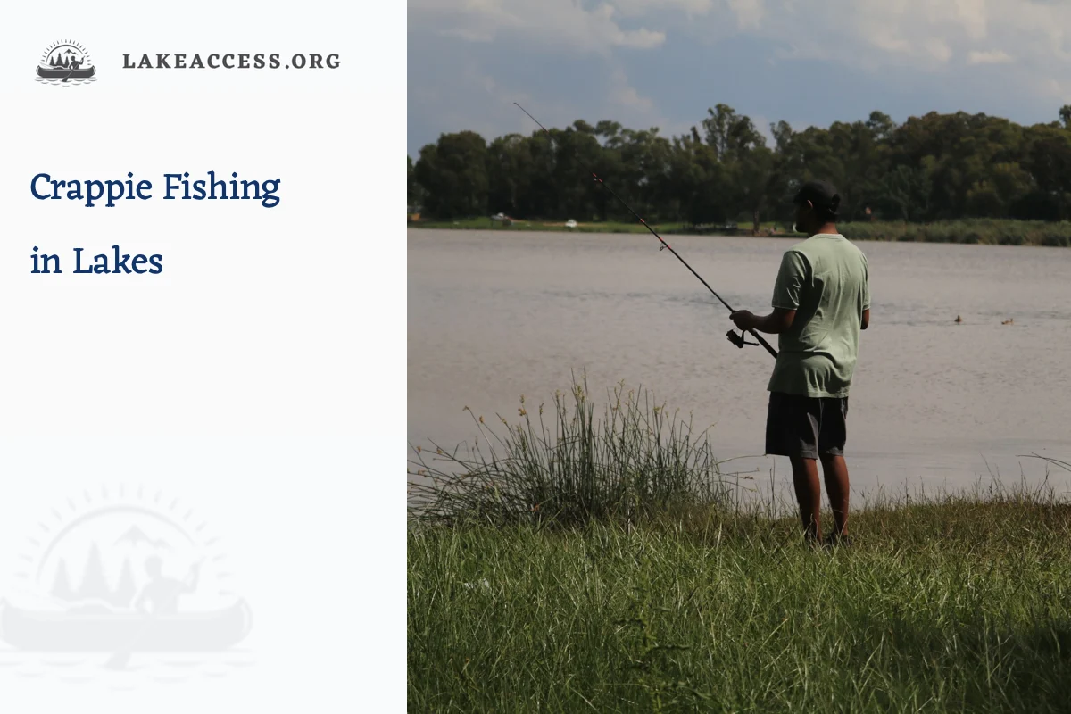
Quick answer: To catch crappie in a lake, search for schools where the season, cover and a usable depth intersect. Begin around warming shallow cover in spring, follow weed edges, timber, docks and channel-related structure after the spawn, and slow down around concentrated deep structure in cold water. Use a small jig or legal minnow rig, change depth before changing every other variable, and check the exact lake regulations because size, bag, bait and hook rules vary.
At-a-glance fishing plan
| Target or condition | Where to begin | Useful approach | Verify before fishing |
|---|---|---|---|
| Early spring warming | Protected coves, dark bottoms and cover near deeper water | Small jig or legal minnow below a sensitive float | Water temperature trend, access and pre-spawn rules |
| Spawn and immediate post-spawn | Brush, vegetation, gravel and the first nearby break | Quiet casts, vertical jigging or a slip bobber | Species identification, nesting ethics and harvest limit |
| Summer and early fall | Docks, standing timber, weed edges and channel structure | Count down a jig or hold bait at the school depth | Thermocline, oxygen, boat traffic and special rules |
| Late fall and winter | Deep cover and compact schools with a safe route home | Slow vertical presentation with minimal movement | Cold-water safety, ice status where applicable and possession limit |
Treat depth as a measured variable
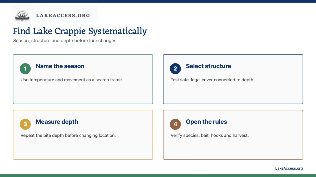
Crappie often school, but a school can occupy a narrow band above brush or beside a break rather than sitting on the bottom. Start with the water column that fits the season, then work shallow, middle and deep presentations in a controlled sequence. Mark the depth of each bite and repeat it before changing location.
A contour map identifies candidate structure, not the fish or a safe route. Compare it with present lake level, visible cover and sonar where available. Keep the boat or bank position outside submerged timber and do not cast into a navigation lane, private dock space or signed spawning refuge.
Choose a simple jig, minnow or float system
A small jig can be cast, counted down or fished vertically. A slip float can hold a jig or legal live bait at a repeatable depth. Match hook and bait size to crappie rather than hiding a large hook in excess bait, and use only the number of hooks and live-bait species the jurisdiction permits.
Begin with natural movement and a slow retrieve. In stained water, a visible profile and close presentation may matter more than long casts; in clear water, distance and a quiet approach can help. These are testable adjustments, not color guarantees. Change one factor, record the response and keep tackle clear of branches, dock cables and other anglers.
Separate black and white crappie from a guess
Black and white crappie can overlap, and color alone is not a reliable shortcut. Use an official identification guide and the full set of features required by the managing agency. When identification changes the rule, release an uncertain fish immediately rather than adding it to a mixed creel.
Measure retained fish on a rigid board and track the party total. Local exceptions can be more restrictive than statewide summaries, and possession rules can continue after leaving the lake. Review fish-consumption advice before harvest because a legal crappie is not automatically the recommended meal for every water or person.
Build a repeatable one-hour search
Spend the first block checking two structure types at several depths instead of racing among unverified hotspots. Make a defined number of casts or vertical drops, note the cover, depth and wind, then move to the next comparable area if there is no evidence. Once fish are located, minimize unnecessary repositioning and avoid crowding another boat.
From shore, cast parallel to reachable cover before throwing toward featureless open water. From a boat, control drift and maintain a lookout while working vertically. Stop when wind, lightning, cold, low visibility or equipment failure compromises the return. Crappie fishing is never a reason to remain beside timber or a bridge during deteriorating weather.
Build the trip around current conditions, not a permanent hotspot
A useful fishing plan begins with a date, a legal access point and the conditions expected during the hours you will actually be on the water. Lake level, water temperature, wind direction, recent rain, visibility and boat traffic can change how a familiar shoreline or channel fishes. Record the source and update time for every live observation. A report from a different basin, an old social post or a successful trip from another season is background information, not proof of what the lake is doing now.
Start broad. Identify the season, the target species and whether the fish are likely using shallow cover, a breakline, an open-water food source or a deeper temperature and oxygen refuge. Then choose several legal areas with the same habitat type instead of one coordinate. This approach remains useful when wind, crowding, water level or a closure makes the first choice impractical. It also avoids directing readers to private property or implying that a named location guarantees a catch.
Use depth and structure as a repeatable search method
Contour maps help describe changes in depth, but they do not show every stump, weed edge, dock, current seam or newly exposed hazard. Read contours as a set of relationships: a flat connected to deeper water, a point intersecting a channel, a creek arm narrowing toward moving water, or a steep bank that continues below the surface. Compare the map with present lake level and what the sonar or visible shoreline shows. Never treat an old contour line as a navigation instruction.
Move from large features to small ones. First select a basin or creek arm that fits the season. Next identify a depth transition, cover edge or feeding route. Finally, make controlled casts at different angles and depths while noting temperature, wind and fish activity. If there is no response, change one variable at a time. A clear search log is more useful than repeatedly changing location, lure, speed and depth without knowing which adjustment mattered.
Match tackle to habitat without overcomplicating the setup
Choose line strength, hook, leader, weight and rod action for the cover, target species and current regulations. Lighter presentations can be useful in clear water, but the setup still needs enough control to keep a fish away from wood, rock, vegetation, dock hardware and anchor lines. Heavier tackle is not permission to force a fish through unsafe obstacles or to cast across another person’s water. Inspect knots, guides and damaged line before leaving the ramp.
Carry a small range of presentations that cover the water column: one for the surface or shallow zone, one for mid-depth searching and one that can reach bottom or a defined break. Match hook size to the bait and likely fish rather than using the largest available option. Store spare hooks securely, keep tools accessible and remove damaged tackle from service. Product instructions and local rules control rigging details when a technique, live bait or number of hooks is restricted.
Separate seasonal tendencies from promises
Spring warming often draws fish toward productive shallows and tributary areas, but cold fronts, high flow and rapidly changing levels can interrupt that movement. Summer can concentrate some species around shade, current, deeper structure or low-light feeding periods while recreational traffic increases. Fall cooling can spread bait and create active feeding windows. Winter patterns may be slower or deeper, but they still depend on weather, oxygen, forage and the specific species.
Use these tendencies to decide what to check, not to publish a fixed depth or calendar guarantee. Water temperature at the launch can differ from a sheltered cove or the main channel, and a surface reading does not describe the entire water column. Confirm present observations and keep a second plan for wind, storms, turnover, muddy inflow or unexpectedly heavy traffic. Local regulations may also create closed seasons or species-specific rules that override any tactical suggestion.
Plan shore fishing as an access problem first
Visible shoreline is not automatically public shoreline. Confirm the managing agency, posted boundary, hours, parking and whether fishing is permitted at the exact pier, park, trail or bank. A public road, bridge or utility corridor does not automatically grant a safe place to park or cross adjacent land. Stay out of launch lanes, marina work areas, swimming zones, private docks and signed restoration areas. Leave room for walkers and people using accessible routes.
Once access is confirmed, look for reachable habitat: a point, drop beside a pier, creek mouth, shade line, riprap transition or vegetation edge. Cast parallel to cover before sending every presentation toward open water. Keep bags, rods and hooks contained so they do not block the route. Rising water, slippery rock, heat, darkness and severe weather can make an otherwise legal bank unsafe, so choose an exit before fishing and leave promptly when conditions change.
Plan boat fishing from the ramp outward
A launch plan includes more than finding a ramp symbol. Verify current hours, fees, permits, parking, water level, lane condition and any closure or construction notice. Prepare the boat away from the active lane, use the drain plug and safety chain correctly, and move to a designated area before arranging fishing equipment. Everyone should have an appropriate wearable life jacket, and the operator should know the local navigation and no-wake rules.
On the water, maintain a lookout and give docks, paddlers, swimmers, anchored boats and other anglers adequate space. Wind can build a hazardous fetch on a large lake even when a cove is calm. Watch the return route as carefully as the fishing area, preserve battery or fuel margin and do not wait for a storm to reach the lake before leaving. Reservoir generation, current and changing levels can affect ramps, shoals and river sections.
Check the complete regulation set on the day of fishing
Licenses, seasons, size limits, daily limits, possession limits, legal methods and bait rules can vary by water, species, date and angler status. Read the current state regulations and then search for the named waterbody and any special rule. A statewide summary is not enough when a reservoir has an exception. Keep the official regulation available offline and use the agency contact when the waterbody name, boundary or species identification is uncertain.
Count fish retained by the entire party and understand how possession rules apply after leaving the water. Measure fish with an appropriate board, release prohibited fish immediately and avoid extended handling for photographs. Do not move live fish, bait water, plants or animals between waters. Tournament rules, marina policies and park hours are additional requirements; they do not replace the state fishing and boating rules.
Review fish-consumption advice before deciding to keep a catch
A legal fish is not automatically the best fish to eat. State health and environmental agencies publish advice by waterbody, species, fish length and consumer group. Check the current advisory before the trip so a retention decision can be made quickly and the fish can be handled appropriately. General statewide advice may apply when a water is not listed, while a named advisory can be more restrictive.
Record where the fish was caught and identify the species correctly. Cleaning or cooking methods do not remove every contaminant, and advice for one lake should not be transferred to another waterbody with a similar name. People who are pregnant, may become pregnant, are nursing or are feeding children may receive different guidance. The agency’s current tool or publication controls; an article cannot diagnose exposure or replace medical advice.
Fish safely around weather, cold water and remote shorelines
Check the National Weather Service forecast, radar and any marine or severe-weather alert before departure and while conditions permit. Thunder, increasing wind, fog, extreme heat and cold water each require a conservative response. A life jacket is especially important in cold water, on moving boats and when fishing alone. Tell someone the launch, general area and return time, and carry communication that works where cellular coverage is limited.
Keep hooks controlled, use eye protection when appropriate and create space before casting. Carry drinking water, sun protection, first aid and a light even for a planned daytime trip. Stop fishing when lightning, unsafe wind, poor visibility, equipment failure or a health concern makes the return uncertain. Emergency response can take longer on a large or remote lake, so the safe decision is made before the margin disappears.
Prevent aquatic invasive species at every access
Follow the current state clean, drain and dry requirements. Remove plants, mud and animals from the boat, trailer, anchor, livewell, waders and fishing equipment. Drain water where required and never release bait, aquarium species or a fish into a different water. Inspect small places such as rollers, bunks, transducers, lower units and knots where material can remain hidden.
Complete the inspection both before entering and after leaving the water. A lake may have local decontamination instructions or a prohibited-species notice, and the rule can apply even when no vegetation is obvious. Keeping one set of equipment lake-specific or allowing adequate drying time can reduce transfer risk, but it does not replace a required inspection, drain or decontamination step.
Keep a simple fishing log that improves the next decision
Write down the date, time, weather, water temperature source, lake level source, visibility, wind, habitat, depth range, presentation and observed activity. Note access problems, posted rules and the time live data was checked. The goal is not to publish a secret coordinate; it is to recognize which combination of season, conditions and habitat produced useful evidence.
Include unsuccessful periods. They show when a habitat or presentation did not match the observed conditions and help prevent repeating the same assumption. Review the log beside official level, temperature and weather records after the trip. Over time, this creates a personal method that is more durable than a one-day report and safer than chasing unverified location advice.
Pre-trip checklist
- Confirm black and white crappie identification.
- Open current statewide and named-water regulations.
- Choose two legal structure types and several test depths.
- Rig a small jig or permitted minnow system before reaching the water.
- Check fish-consumption guidance before keeping the catch.
Related LakeAccess guides
- Catfish fishing in lakes
- How to read a lake map for fishing
- Shore fishing setup for lakes
- Essential lake fishing safety tips
Sources
Rules, access and live conditions can change. These official or high-trust sources were checked on July 22, 2026; open them again for the trip date.
- Missouri Department of Conservation crappie fishing tips (checked July 22, 2026)
- U.S. Fish and Wildlife Service black crappie profile (checked July 22, 2026)
- Wisconsin DNR fish identification directory (checked July 22, 2026)
- U.S. Fish and Wildlife Service first-time fishing guide (checked July 22, 2026)
- Missouri Department of Conservation crappie regulations (checked July 22, 2026)
- EPA fish and shellfish advisories (checked July 22, 2026)