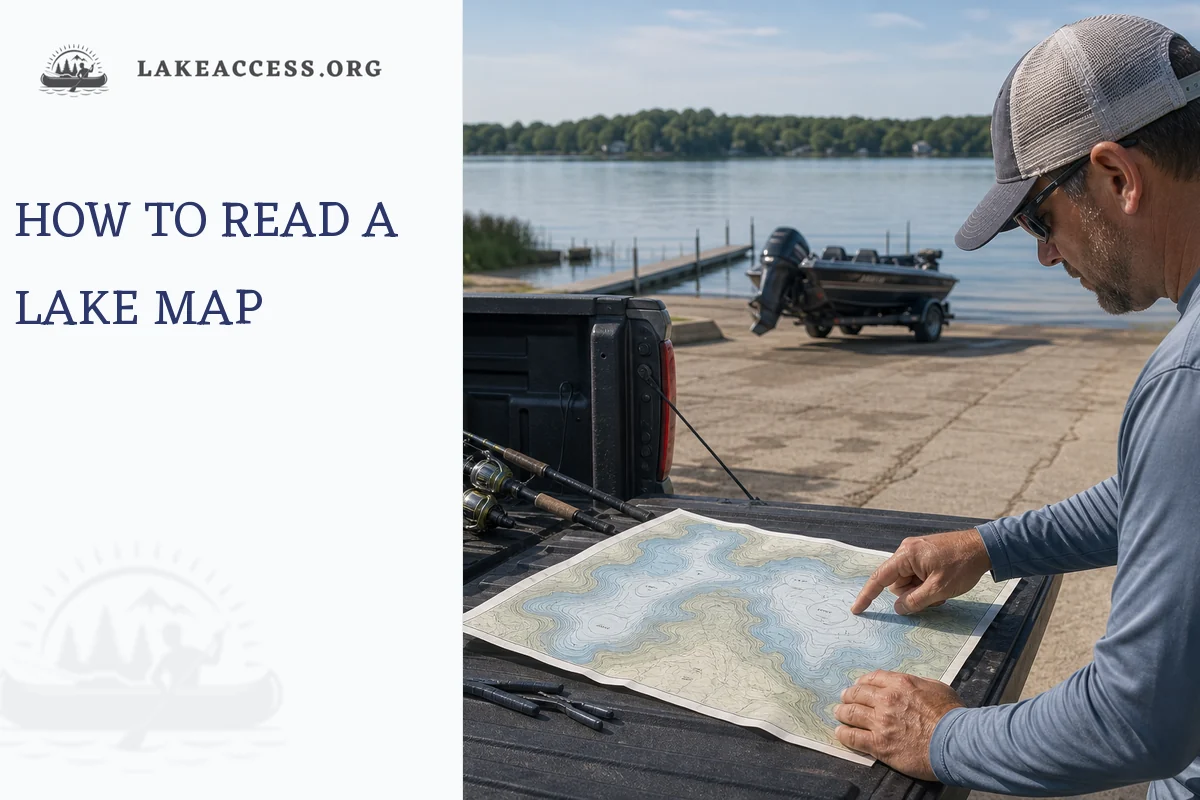
The fastest way to read a lake map for fishing is to start with the legend, depth units, contour interval, and scale, then look for structure: points, humps, saddles, creek channels, flats, weed edges, and steep drop-offs. Those features help you choose where fish may travel, feed, or hold. A lake map does not guarantee fish, and it does not replace current regulations or safe boating judgment, but it gives you a plan before you ever launch.
If you have ever opened a lake map and seen a bowl of squiggly lines, you are not alone. Those lines are the useful part. Once you learn what they mean, a lake map becomes less like a puzzle and more like a shortlist of places worth checking.
Start with the legend, not the lake
Before picking a spot, read the small print. The legend and margin notes tell you what the map is actually showing.
| Map item | What to check | Why it matters for fishing |
|---|---|---|
| Depth units | Feet, meters, or fathoms | A “20” means very different things depending on the unit. |
| Contour interval | The depth change between contour lines | A 5-foot interval shows detail that a 20-foot interval may hide. |
| Scale | Distance on the map | Helps you judge whether a point is a short cast or a long idle from the ramp. |
| Survey date | When the bottom was mapped | Older maps may miss newer sediment, vegetation, docks, or changed channels. |
| Datum or pool level | The water level the depths are based on | Reservoir depth can shift when the lake is above or below normal pool. |
| Symbols | Ramps, hazards, marinas, fish attractors, boundaries | These shape both your route and your fishing plan. |
On some official fishing maps, depth contours are based on a normal pool elevation and may include a note that contours can change with water levels or bottom alteration. Treat that note seriously. A map is a planning tool. Your eyes, electronics, local notices, and safe speed still matter on the water.
Quick safety note: if the water is navigable, busy, unfamiliar, or connected to larger charted waters, use the best official navigation source available for that water. Fishing maps are often not intended to be navigation charts.
Read the depth contours first
Depth contour lines connect places with the same depth. Think of them as underwater elevation lines. On land, tight contour lines mean steep terrain. Underwater, tight depth contours usually mean a fast drop. Widely spaced lines usually mean a flatter bottom.
The key is not memorizing every depth. The key is seeing shape.
| Contour pattern | What it usually means | Why anglers care |
|---|---|---|
| Tight parallel lines | Steep break or drop-off | Fish can move from shallow feeding water to deeper holding water quickly. |
| Wide-spaced lines | Flat or gradual slope | Good for roaming fish, spawning areas, or low-light feeding flats. |
| Closed oval with shallower numbers inside | Hump or underwater island | Classic offshore structure, especially when near deep water. |
| Closed oval with deeper numbers inside | Hole or basin | Can hold fish in winter, summer, or during tough conditions. |
| Long taper from shore | Point | A travel route and ambush edge for many species. |
| Two high spots with a lower gap | Saddle | Fish often move through the low gap between structures. |
| Winding deeper slot | Creek channel or river channel | A travel corridor, especially in reservoirs. |
| Sharp bend in a channel | Channel swing | A high-percentage place where depth and edge meet. |
Here is the lazy rule that works: find the places where shallow and deep water are close together, then ask whether fish have a reason to be there.
Find structure, then find the best part of it
“Structure” is the shape of the bottom. “Cover” is the stuff on it, such as vegetation, brush, docks, rocks, or timber. A map is usually better at showing structure than cover, though some state maps and fishing apps mark fish attractors, vegetation, or submerged timber.
Start with these map features:
| Feature | Best-looking version on a map | How to fish it |
|---|---|---|
| Main-lake point | Tapers into deep water or touches a channel | Cast across the point, then along both sides of the break. |
| Secondary point | Inside a creek arm or bay | Check during spring, fall, and low-light feeding windows. |
| Hump | Tops out near a useful depth and has deep water nearby | Fish the crown, then the first break around it. |
| Saddle | Connects two humps, points, or islands | Work the low spot like a travel lane. |
| Creek channel | Swings close to a flat, point, or bank | Focus where the channel edge touches another feature. |
| Flat | Has a nearby break, ditch, weedline, or hard-bottom edge | Search with moving baits, then slow down where bites happen. |
| Basin edge | Transition from deep basin to rising slope | Useful for suspended fish, panfish, and winter patterns. |
| Neck or narrows | Pinches movement between lake sections | Treat it like a funnel, especially with wind or current. |
The best spot is rarely “a point” by itself. It is the point with wind on it, bait nearby, a weed edge, a hard-bottom patch, or a quick drop into deeper water.
Match the map to the season
Fish do not use the whole lake equally all year. A contour map helps you narrow the search, but season, water temperature, clarity, oxygen, forage, fishing pressure, and weather all matter.
| Season | Map areas to inspect first | Why they can matter |
|---|---|---|
| Spring | North-facing bays, shallow flats, creek arms, protected pockets, secondary points | Shallow water can warm faster, and many species move shallower for feeding or spawning periods. |
| Summer | Weed edges, first deep break, offshore humps, main-lake points, creek channels | Fish often split between cover-rich shallow water and deeper, more stable zones. |
| Fall | Main-lake points, channel swings, baitfish routes, narrowing creek arms | Cooling water can move bait and predators into more active feeding patterns. |
| Winter | Basins, humps, saddles, points, narrows, safe access routes | Under ice, structure still matters, but ice safety and local conditions come first. |
Do not force the season table to be a rulebook. Use it as a starting filter. If your electronics, catches, bird activity, or local reports say the pattern is different, trust the fresh evidence.
Use depth as a range, not a magic number
Anglers love exact depths: “They are in 17 feet.” Sometimes that is true for a day. Often, it is more useful to think in ranges and edges.
For example:
- Instead of marking every 20-foot contour, mark where the 15-to-25-foot break touches a point.
- Instead of fishing an entire flat, fish the edge where the flat drops into a channel.
- Instead of idling every offshore hump, start with humps that top out near the depth where you saw bait or caught fish.
Once you catch a fish, look back at the map. Was it on the windy side? The steep side? The inside turn? The first break? The deepest cover? One bite is a clue. Three similar bites are a pattern.
Read access and hazards before choosing spots
A good fishing spot is not useful if you cannot reach it safely or legally. Before you build a plan around an offshore hump or a far creek arm, check the practical layer of the map.
Look for:
- Public boat ramps and bank access
- Parking and marina symbols
- No-wake zones or restricted areas
- Shallow flats between the ramp and your spot
- Submerged roadbeds, timber, rocks, shoals, or stump fields
- Dams, spillways, intake zones, and marked exclusion areas
- Bridges, narrows, and high-traffic lanes
- Public land boundaries and private shoreline limits
The U.S. Coast Guard notes that aids to navigation are not intended to mark every shoal or obstruction. That applies neatly to fishing: do not assume an unmarked area is hazard-free. Idle when uncertain, wear a properly fitted life jacket, and keep a lookout.
Paper map, phone app, chartplotter, or sonar?
Use the simplest tool that answers the question in front of you.
| Tool | Best use | Main limitation |
|---|---|---|
| Printed lake map | Pre-trip planning and big-picture structure | No live position unless you pair it with GPS. |
| State lake database | Official surveys, depth maps, access, water quality, regulations | Coverage and map age vary by state and lake. |
| Fishing app | GPS position, saved waypoints, offline maps, shaded depth ranges | Data source and accuracy vary; subscriptions may not equal official status. |
| Chartplotter | Boat-based navigation and waypoint management | Still depends on map data, settings, and operator judgment. |
| Sonar | Real-time depth, bottom hardness clues, bait, fish, vegetation | Small viewing area; easy to stare at the screen and stop fishing. |
The clean workflow is: plan with the map, navigate cautiously, verify with sonar, then save only the waypoints that teach you something.
A simple 10-minute map routine
Use this before a new-lake trip or when you only have a few hours to fish.
5-Step Lake Map Scan
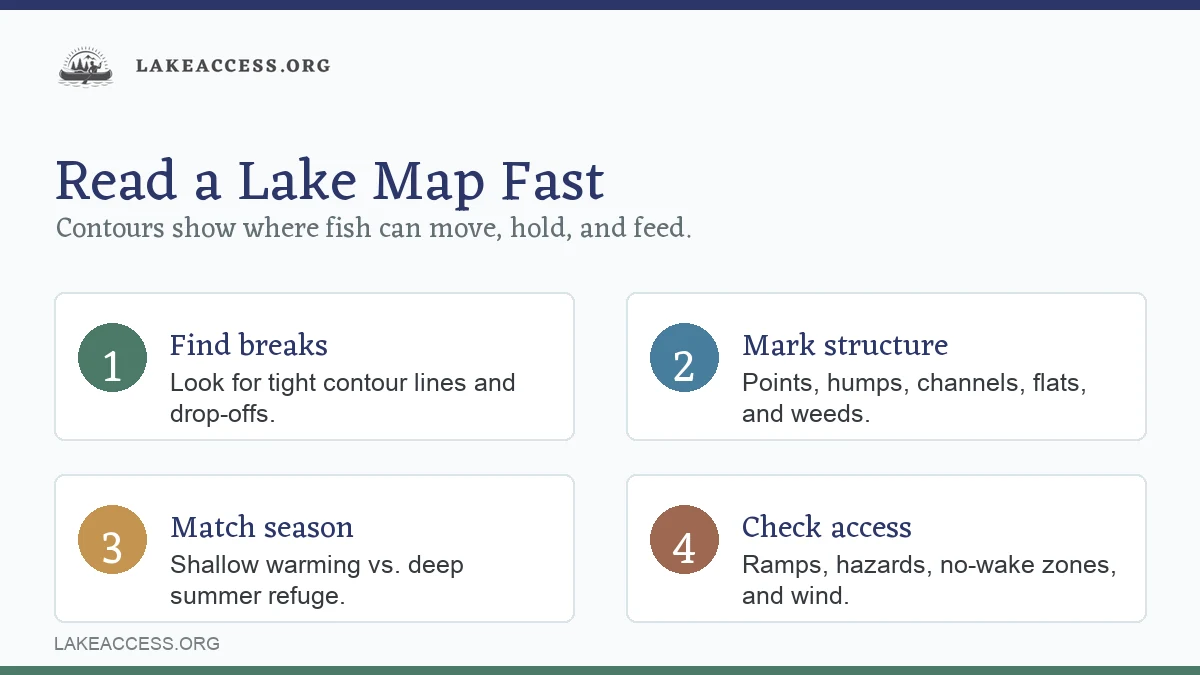
- Read the legend. Confirm depth units, contour interval, scale, survey notes, and symbols.
- Mark three structures. Pick one point, one drop-off, and one flat or hump near deep water.
- Check access. Choose the safest ramp, route, and backup area for wind or boat traffic.
- Match the season. Start shallow, deep, or transitional based on time of year and conditions.
- Verify official info. Check fishing regulations, emergency changes, advisories, and water conditions before you go.
Here is what that looks like in practice. Say you are studying a reservoir map the night before a bass or walleye trip. You find a public ramp near the middle of the lake. A creek channel swings close to a long point half a mile away. Across the channel is a flat that drops from 8 to 22 feet. Farther out, a small hump tops at 14 feet and falls into 35.
That gives you a clean plan:
- Start on the point at low light.
- Slide to the channel swing if fish are not shallow.
- Check the flat edge if bait or wind is present.
- Use the offshore hump as a midday option.
- Keep a protected bank or closer ramp area as the wind backup.
No drama. No need to map the entire lake. You just need enough good decisions to start fishing intelligently.
Common lake map mistakes
The first mistake is fishing the icon instead of the feature. A fish attractor symbol, brush pile, or marked reef may draw pressure. Fish might hold nearby rather than directly on the symbol. Cast around it, not just at it.
The second mistake is ignoring the contour interval. If the interval is 10 feet, a “flat” might still have small ditches, rock veins, or grass edges the map cannot show. Sonar, polarized glasses, and careful observation fill in the missing detail.
The third mistake is treating old maps as current truth. Reservoirs silt in. Vegetation expands or disappears. Water levels change. Boat ramps close. Regulations change. Use official state or managing-agency sources for current rules and notices.
The fourth mistake is choosing spots before checking wind. A perfect offshore hump may be miserable or unsafe in heavy wind. A protected secondary point may fish better simply because you can present a bait well.
The fifth mistake is saving too many waypoints. A lake map should help you reduce clutter. Keep waypoints for catches, visible cover, hazards, and repeatable patterns. Delete random guesses that never produce.
Official checks before you fish
Lake maps are only one part of trip planning. Before keeping fish or launching somewhere new, check:
- Current fishing license requirements
- Size limits, bag limits, slot limits, and seasons
- Emergency rule changes or temporary closures
- Fish consumption advisories
- Boat ramp status and access restrictions
- Water level, dam release, or drawdown notices where relevant
- Weather, wind, lightning risk, and ice conditions
NOAA Fisheries points anglers to state fish and wildlife agencies for state-water fishing licenses and regulations. State agencies may also publish emergency rule changes, mobile regulation tools, lake surveys, and advisories. For eating your catch, EPA guidance points readers toward current state, territorial, or Tribal fish advisory programs.
Related LakeAccess resources
Use these next if you want to turn map reading into a full trip plan:
- Fishing for more lake fishing guides and tactics.
- Guides for broader lake trip planning.
- Boating for boat choice, setup, and safety topics.
- How to Fish for Trout in Lakes and Rivers if your map search is focused on trout water.
- Best Tips and Tactics for Catfish Fishing in Lakes and Rivers if you are looking for channels, holes, and river arms.
- Pyramid Lake Fishing for an example of a destination where rules and local conditions matter.
- Canyon Lake, Texas for a lake-profile style trip-planning read.
- Lake Winnipeg Ice Fishing Guide for winter structure thinking and ice-fishing context.
FAQ
What do the lines on a lake map mean?
On most fishing lake maps, the lines are depth contours. Each line follows the same depth around the lake. Close lines usually show a steep slope or drop-off. Spread-out lines usually show a flatter area. Closed circles can show humps or holes, depending on whether the numbers get shallower or deeper toward the center.
What is the most important thing to find on a lake map?
Find depth changes near useful structure. A point, hump, saddle, channel swing, or weed flat becomes more interesting when fish can move quickly between feeding and holding depths. Access, safety, season, and current regulations still matter.
Are lake fishing maps accurate?
They are useful, but not perfect. Accuracy depends on the survey method, survey date, water level, sediment changes, vegetation, and map scale. Official maps may include notes about contour intervals, normal pool elevation, or whether the map is suitable for navigation. Read those notes before relying on the map.
Should I use a fishing map or a navigation chart?
Use a fishing map to find structure and plan fishing spots. Use official navigation charts or the best available navigation source when safe routing is the priority, especially on large, connected, commercial, coastal, or Great Lakes waters. On any lake, travel cautiously and verify depth and hazards in real time.
How do I pick my first spot on a new lake?
Choose a spot that combines three things: structure, access, and a seasonal reason. For example, a point near deep water and close to the ramp is better than a random shoreline. If that point also has wind, bait, vegetation, or a channel nearby, it becomes a stronger first stop.
Sources
- NOAA U.S. Chart No. 1 — Used for official nautical chart symbols, abbreviations, and terminology.
- NOAA Electronic Navigational Charts — Used for the role of official electronic charts in navigation, real-time positioning, and grounding avoidance.
- USGS Topographic Maps — Used for current and historical topographic map context and USGS map access.
- USGS Topographic Map Symbols PDF — Used for contour-line basics, contour intervals, map colors, and bathymetric contour explanation.
- Minnesota DNR Lake Mapping — Used for the idea that lake maps help anglers identify sunken points, drop-offs, mud flats, and other lake structures.
- Minnesota DNR LakeFinder — Used as an example of an official state lake database with lake surveys, depth maps, water quality, and regulations.
- Ohio DNR Lake and Reservoir Fishing Maps — Used as an example of official fishing maps with depth contours, fishing access, and fish attractor information.
- Ohio DNR Alum Creek Lake Fishing Map PDF — Used for examples of contour interval, normal pool elevation, survey date, and "not suitable for navigation" caveats on fishing maps.
- U.S. Coast Guard Navigation Rules — Used for boating safety context, navigation rules, and the limits of aids to navigation.
- NOAA Fisheries Recreational Fishing Resources — Used for the reminder to check state fish and wildlife agencies for recreational fishing licenses and regulations.
- EPA Choose Fish and Shellfish Wisely — Used for fish consumption advisory context and the need to check current state, territorial, or Tribal advisories.
- Washington Department of Fish and Wildlife Fishing Regulations — Used as a current example of checking annual rules, emergency rule changes, and mobile regulation tools before fishing.
State Lake Research Guides
Use these state guides with a lake map, current regulations, and official access sources.