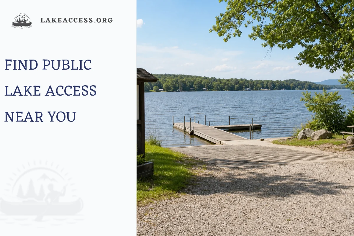
Looking for public lake access near you? Start with your activity: swimming, boating, fishing, paddling, or camping. Then use official maps from state parks, fish and wildlife agencies, Recreation.gov, Corps Lakes, the Forest Service, or local park departments to confirm that the access point is public, open, legal for your activity, and safe today. Before you drive, check parking, fees, hours, boat ramp status, swim advisories, weather, and any permit rules.
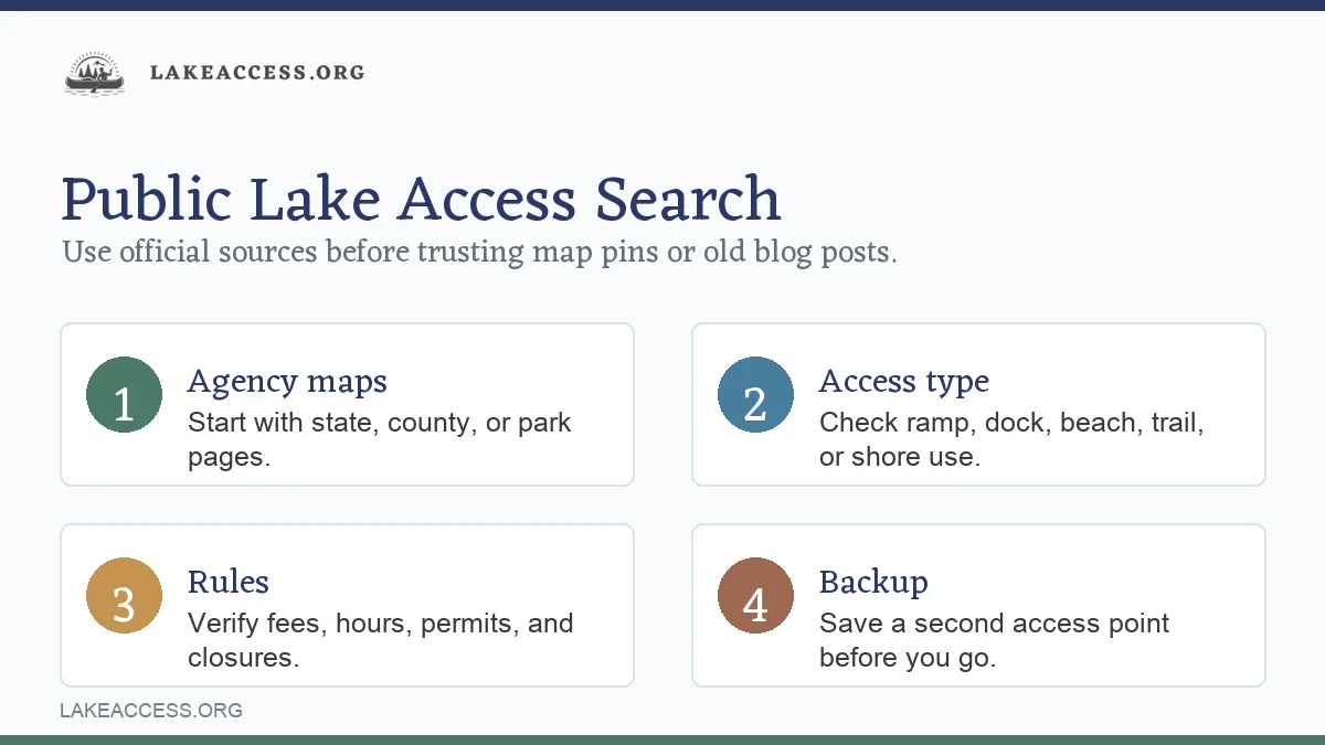
The mistake is assuming every road to the water is public. Many lakes mix state parks, federal land, city beaches, private marinas, HOA shorelines, utility property, and conservation areas. A good access point is not just “a spot on the map.” It is a place where the managing agency says you can enter, park, launch, swim, fish, or camp.
Start with the kind of access you need
“Lake access” can mean very different things. A public fishing pier may not allow swimming. A swim beach may not allow kayaks. A boat ramp may be public but require a launch fee, invasive species inspection, day-use pass, or seasonal gate code.
| If you want to… | Search for… | Best official sources to check | Watch for |
|---|---|---|---|
| Swim | Public beach, swim area, day-use area | City/county parks, state parks, EPA/BEACON, local health department | Advisories, lifeguard status, swim boundaries, pets, alcohol rules |
| Launch a boat | Boat ramp, launch site, marina, access area | State boating agency, fish and wildlife agency, USACE, county parks | Ramp depth, fees, parking, horsepower/no-wake rules, closures |
| Paddle | Canoe/kayak launch, hand-carry access, water trail | State parks, Forest Service, local parks, water trail maps | Motorboat traffic, portage distance, wind exposure, take-out location |
| Fish from shore | Shore fishing, fishing pier, public access, wildlife area | State fish and wildlife agency, parks department | License rules, species limits, private shoreline, night access |
| Camp near the water | Lake campground, boat-in site, day-use pass | Recreation.gov, state parks, USFS, USACE, county parks | Reservation window, vehicle limits, pet rules, fire restrictions |
Use broad web searches only to discover names. Use official pages to verify the details.
The 10-minute public access check
The fastest reliable method is to cross-check a map result against the agency that manages the land.
Public Lake Access Finder
- Pick the activity. Swim, launch, paddle, fish, picnic, or camp.
- Search official maps. Try state parks, fish and wildlife, Corps Lakes, Recreation.gov, Forest Service, or city/county parks.
- Confirm it is public. Look for an official access page, park page, boat ramp listing, or managed recreation area.
- Check the details. Hours, fees, parking, restrooms, ramp type, pets, permits, and seasonal gates.
- Check today’s risks. Swim advisory, harmful algae, high water, low water, weather, waves, currents, or fire restrictions.
- Save a backup. Have a second legal access point in case the lot is full or the ramp/beach is closed.
1. Search federal tools first for federal lakes and public lands
If the lake is on federal land, start with federal tools:
- Recreation.gov for many federal campgrounds, day-use areas, permits, and reservable recreation sites.
- Corps Lakes and the USACE operational status map for U.S. Army Corps of Engineers lake recreation areas.
- Forest Service maps and the Interactive Visitor Map for national forest roads, recreation sites, wilderness areas, and travel rules.
- National Park Service Find a Park for national parks, national recreation areas, and official park pages.
Federal pages are especially useful for campgrounds, boat ramps, day-use beaches, seasonal closures, and facility status. They do not always include state, county, city, or private marina access, so keep going if the lake is locally managed.
2. Use your state fish, wildlife, or boating agency for ramps
For boat ramps and shore fishing, state agencies are often better than general map apps. Search:
- “[your state] public boat ramp finder”
- “[your state] fishing access map”
- “[lake name] public boat launch site”
- “[county name] lake access permit”
Many state tools list ramp type, trailer parking, accessibility, restrooms, dock availability, and cautions. The USGS public boat ramp dataset is useful context, but local and state agency pages are usually better for current status, fees, and rules.
3. Use city, county, and utility pages for local reservoirs
Some of the best lake access is not federal or state. It may be a city beach, county park, water district reservoir, power-company recreation area, or public-private marina concession.
Search the lake name with:
- “official park”
- “public access”
- “boat ramp”
- “swim beach”
- “day use”
- “reservoir recreation”
- “county parks”
- “water district”
Then look for the managing body. A page from the city, county, state park system, water authority, USACE district, Forest Service, or official concessionaire is stronger than a generic travel list.
How to tell if lake access is actually public
A map pin does not prove public access. Before you go, confirm at least two of these:
| Public-access clue | What it means | Still verify |
|---|---|---|
| Official park or agency page | The site is managed for public recreation | Hours, fees, closures, allowed activities |
| Boat ramp listed by state agency | The ramp is intended for public launching | Water level, parking, permit, ramp condition |
| Day-use area or beach page | Public visitors are expected | Swim status, lifeguards, pets, alcohol, grills |
| Reservation page | The site is managed and bookable | Whether access is for campers only or day users too |
| Posted public access sign | Good on-site confirmation | Current rules on the sign beat old blog posts |
Be cautious with “unofficial” access. Road-end parking, neighborhood docks, utility roads, dam embankments, railroad corridors, and shoreline paths can be private or restricted even when they look open. If an official map does not show access, call the managing agency before assuming.
Check current conditions before swimming
For swimming, the access question is only half the job. A public beach can still be temporarily unsafe or closed.
Check:
- The beach or park’s official page.
- Local health department advisories.
- EPA beach information and BEACON for monitored beaches and advisories where available.
- NOAA BEACON 2.0 for state-reported beach monitoring and closure data for coastal and Great Lakes recreational waters.
- Local weather and, on the Great Lakes, National Weather Service beach hazards.
Avoid blanket assumptions like “the lake is clean” or “the beach is always open.” Bacteria levels, harmful algal blooms, storm runoff, high water, debris, waves, and staffing can change quickly.
If the water is scummy, discolored, paint-like, foul-smelling, or has posted bloom warnings, stay out and keep pets away. The CDC warns that harmful algal blooms can make people sick and can be especially dangerous for dogs.
Check access rules before boating or paddling
For boating, the key questions are:
- Is there a public ramp or hand-carry launch?
- Is the ramp open at the current water level?
- Is there trailer parking?
- Is there a launch fee or pass?
- Are motorboats, PWCs, kayaks, or paddleboards allowed?
- Are there horsepower, no-wake, inspection, or invasive species rules?
- Is night access allowed?
Wear a properly fitted life jacket when boating, paddling, or fishing from small craft. The U.S. Coast Guard says a wearable life jacket can save your life only when you wear it, and state laws may add specific age, vessel, or activity requirements.
Simple search recipes that work
Use these searches instead of only typing “public lake access near me”:
| Goal | Better search |
|---|---|
| General public access | “[lake name] public access official” |
| Boat ramp | “[lake name] boat ramp site:gov” |
| Swimming | “[lake name] swim beach health advisory” |
| Fishing from shore | “[lake name] shore fishing access [state agency]” |
| Kayak launch | “[lake name] kayak launch public access” |
| Camping | “[lake name] campground Recreation.gov state park” |
| Rules | “[lake name] rules fees hours official” |
| Current closure | “[lake name] closure alert park” |
The word “official” helps. So does adding the state agency name, county name, or “site:gov” when you need rules rather than opinions.
What to verify on the access page
Before you commit to a spot, scan for:
- Address and GPS coordinates.
- Managing agency.
- Allowed uses.
- Parking capacity and trailer parking.
- Fees, passes, or reservations.
- Gate hours and seasonal dates.
- Restrooms, drinking water, and trash.
- Accessibility details.
- Pet rules.
- Alcohol, fire, grill, and glass-container rules.
- Boat ramp type and dock availability.
- Swim advisory, lifeguard status, or “swim at your own risk” language.
- Current alerts for closures, construction, low water, high water, algae, wildfire smoke, or severe weather.
If fees, hours, or rules matter to your trip, use the official page or call the office. Third-party listings often lag behind.
Public access does not always mean free
Public lake access can still require payment. Common charges include:
- Day-use parking fee.
- Boat launch fee.
- State park entrance fee.
- County lake access pass.
- Invasive species inspection fee.
- Reservation fee for picnic shelters or campsites.
- Annual ramp or vehicle pass.
That does not make the access private. It means the site is public but managed. The important thing is knowing the fee and payment method before you arrive, especially at unmanned kiosks that may require a card, app, QR code, or exact cash.
Use maps, but do not let maps make the final call
Google Maps, Apple Maps, satellite view, and topographic maps are useful for orientation. The USGS National Map Viewer can help you understand terrain, roads, water bodies, and map layers. But maps can show roads, docks, or shorelines that are not open to public recreation.
For national forests, the Forest Service notes that motor vehicle use maps show where motorized travel is legally allowed, and routes not shown as open are not public motor-vehicle routes even if they look driveable. That same principle is useful everywhere: visible does not always mean legal.
Best sources by lake type
| Lake type | Best first source | Why |
|---|---|---|
| State park lake | State parks website | Official beach, boat ramp, camping, fees, alerts |
| USACE reservoir | Corps Lakes or local USACE district page | Recreation areas, ramp status, day-use parks |
| National forest lake | Forest Service forest page and maps | Roads, recreation sites, seasonal access |
| National park lake | NPS park page | Park-specific rules, permits, alerts |
| City/county lake | Local parks department | Local hours, fees, beach status, parking |
| Fishing-focused lake | State fish and wildlife agency | Ramps, shore access, licenses, regulations |
| Great Lakes beach | Local beach page plus NWS and beach advisories | Waves, currents, swim risk, bacteria advisories |
| Private-marina lake access | Marina’s official page plus lake authority | Launch availability, rentals, slips, public use limits |
Related LakeAccess guides
Plan the rest of the trip with these LakeAccess resources:
- Lake guides
- Outdoor planning guides
- Boating guides
- Fishing guides
- Camping guides
- How do lakes have rip currents?
- Can you swim in Lake Como?
- Jordan Lake swimming
Quick answer: the best way to find public lake access near you
Search the lake name plus your activity, then verify the result on an official source. Use Recreation.gov, Corps Lakes, Forest Service maps, NPS, state park pages, state fish and wildlife ramp finders, county parks, city parks, and local health departments. Confirm public status, allowed use, fees, parking, hours, and current advisories before leaving home.
For a low-stress trip, choose one primary access point and one backup. Save both addresses offline, bring the required pass or payment method, and check the weather and water conditions the morning you go.
Sources
- Recreation.gov — used for federal recreation search and reservation context across participating agencies.
- U.S. Army Corps of Engineers Civil Works Recreation — used for USACE lake recreation context and boat ramp/public facility planning.
- Corps Lakes Recreation Operational Status — used for current USACE-managed recreation area status checks.
- U.S. Forest Service Maps — used for Forest Service visitor maps, recreation sites, public/private boundary context, and motor vehicle map cautions.
- National Park Service Find a Park — used for official National Park Service destination lookup.
- EPA beach information and BEACON — used for beach advisories, closures, and water-quality lookup context.
- NOAA BEACON 2.0 — used for state-reported beach monitoring, advisories, and closures for coastal and Great Lakes recreational waters.
- USGS boat ramp locations dataset — used for public boat ramp location data context.
- USGS National Map Viewer — used for topographic map and base-layer map verification.
- U.S. Coast Guard Life Jacket Wear — used for boating life jacket safety guidance.
- National Weather Service Great Lakes Beach Hazards — used for swim risk, wave, current, and beach hazard forecast checks.
- CDC Harmful Algal Blooms — used for cautious harmful algal bloom safety language.